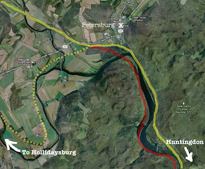
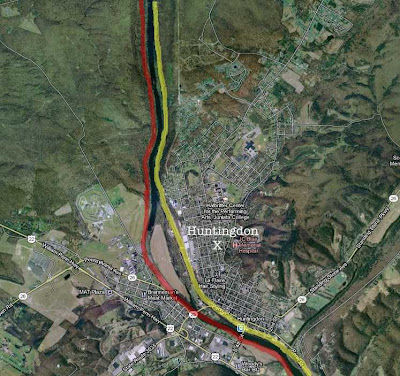
The "High Line" began where the mainline (yellow) met the
branch line (dotted yellow) from Hollidaysburg to the west.
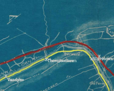
The red line on the blue prints of the PRR map is as drawn.

The red line for the proposed "High Line" is approximate on the following Google images.


 |
| PennDOT Photograph of a portion of the talus rock formation along the Lewistown Narrows or Jack's Narrows on Shade Mountain. Construction across the talus fields would have posed significant problems. |


Hiç yorum yok:
Yorum Gönder